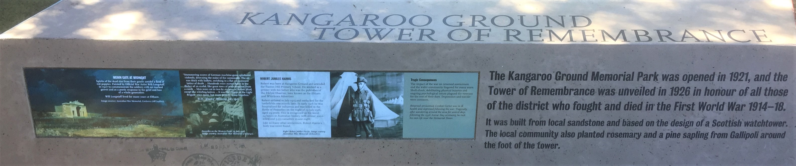
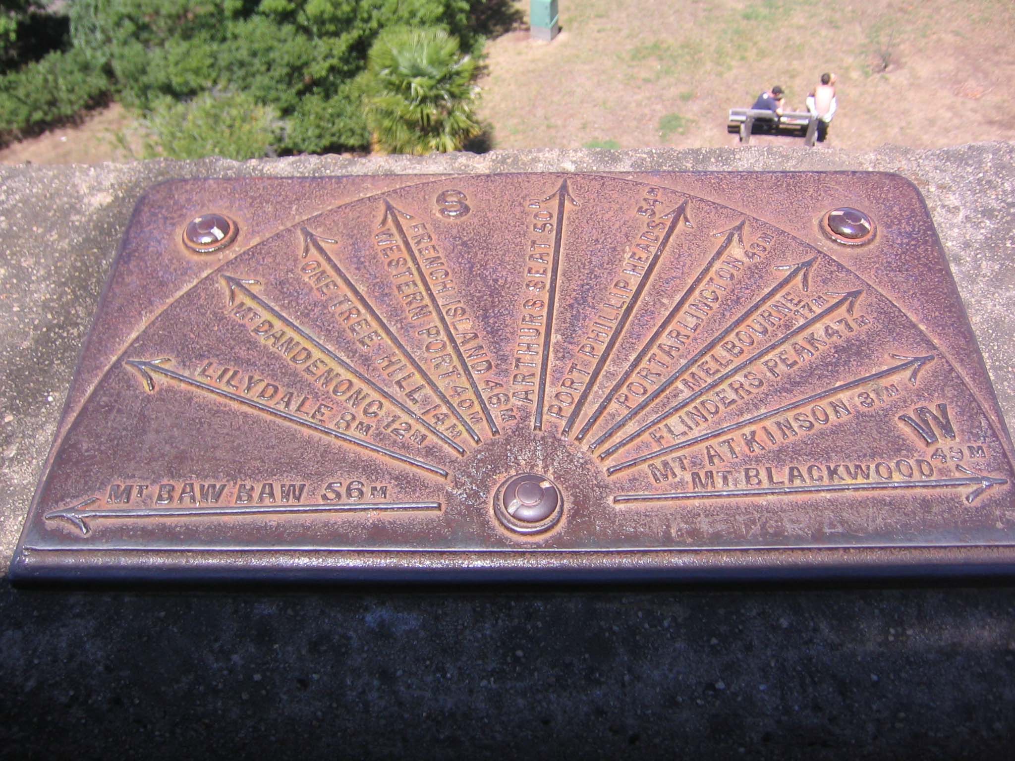
Direction Plaques on the top of the Tower.
These plaques have been part of the Lookout Function of the Tower of Remembrance for many years. Made of cast iron the measure off the distant view in miles. This has been used by Tourists to visualize their journey.
Many towns and scenic spots have developed since this was installed so we have given you a virtual diagram to add in the currents must-see locations. Like The Gawa Trail in Watsons Creek and the Sugarloaf/ Winike Dam in Christmas Hills.
And attached is the BEST drive in the Shire taking in both these “new” must-do destinations.

The View to the East.
1. Mt Donna Buang 25M.
Mt Donna Buang is a mountain in the southern reaches of the Victorian Alps of the Great Dividing Range, located in the Australian state of Victoria. Approximately 80 kilometres (50 mi) from Melbourne with an elevation of 1,250 metres (4,101 ft), Mount Donna Buang is the closest snowfield to Melbourne. In winter, it usually receives snow suitable for snowplay and tobogganing, and during the non-winter months the area is well visited by bushwalkers and cyclists. The summit of Mount Donna Buang is surrounded by Alpine Ash (or Woollybutt) trees and sub-alpine snow gums, and at nearby Cement Creek there is a canopy walkway through Myrtle Beech and mountain ash trees known as the Mount Donna Buang Skywalk. Mount Donna Buang is part of the Yarra Ranges National Park (established in 1995). The nearest serviced town to the mountain is Warburton.
History
In the 1860s, “Mount Acland” was the name given to the 1,250m high mountain by a Police Magistrate called Joseph Anderson Panton. The name it has today, “Mount Donna Buang”, probably came from the Wurundjeri aborigines.
A walking track to the summit of Mount Donna Buang was cut during the 1890s and the much wider Donna Buang Bridle Track, which the current road from Warburton to the top of Mount Donna Buang follows, was opened in 1912.
Timber from the mountain was harvested from the early 1900s to the mid 1920s with seven cable hauled tramways moving logs from the Ben Cairn – Donna Buang ridge down to sawmills near Warburton. While the forest has regrown and the mountain appears to have never been logged, relics such as tram rails and cables can still be found in the forest.
From 1925 to the early 1950s Mt Donna Buang was a popular ski resort. It had four ski lodges, day visitor shelters, cafes, a ski hire, a ski jump and six runs cut through forests of Myrtle Beech and Woollybutt. For over 20 years it had thousands of visitors every weekend there was snow. However, the runs were fairly short and the snow cover was always erratic, so after the Second World War, better transport meant it lost out to higher ski resorts further from Melbourne, although the mountain remained popular with family snow play groups.
Cycling
The road from Warburton to Mount Donna Buang is a challenging cycling route, averaging 6.2% over 16.6 km and has also become a popular destination for recreational driving, motorcycling, and in the summer a challenging training route for endurance cyclists and triathletes.

LEADBEATER’S POSSUM Gymnobelideus leadbeateri
George was found dead but intact on the side of a logging road about 2011 in the Victorian Central Highlands. It is assumed that George’s home in the mountain ash (Eucalyptus regnans) forests was a victim of logging, and as his home was being carted away he fell off the logging truck.

Please copy the following into your search box and enter: https://en.m.wikipedia.org/wiki/Mount_Donna_Buang
2. Mt Baw Baw 56M.
A minor Ski Resort that would like a bit more snow in winter, but for sight seeing is ideal.


Please copy the following into your search box and enter: http://m.visitvictoria.com/Regions/Gippsland/Destinations/Mt-Baw-Baw?MobileRedirected=1
3. Lilydale 8M.
Lillydale township was surveyed in 1860 by Clement Hodgkinson. The Post Office opened on 1 September 1860 as Brushy Creek, and was renamed Lillydale in 1861 and Lilydale around 1872. The Lilydale Hotel opened in 1862. The railway came to town with the opening of the station in 1882. The first town hall was built in 1888 along with the Mechanics Institute Free Library building.
Lilydale has an active CFA volunteer fire brigade, first established in 1905. There was an unregistered brigade dating back to the 1880s prior to this. The brigade also has a satellite station in Chirnside Park. Now is a major suburb of Melbourne.
Please copy the following into your search box and enter: https://en.m.wikipedia.org/wiki/Lilydale,_Victoria
4. Mt Dandenong 12M.
Seen with radio masts and transmission stations is a hub for telecommunications and Tourism. Autumn in the Dandenongs is a riot of coloured leaves on magnificent shrubs and trees. A mecca for Tourists.


Please copy the following into your search box and enter: http://m.visitvictoria.com/Regions/Yarra-Valley-and-Dandenong-Ranges/Things-to-do/Nature-and-wildlife/Dandenong-Ranges-Scenic-attractions?MobileRedirected=1
Please copy the following into your search box and enter: https://en.m.wikipedia.org/wiki/Mount_Dandenong,_Victoria
5. One Tree Hill 14M
Above Ferntree Gully in the Dandenongs. There is One Tree Hill nearby and both were used prior to the First World War to practice signals using a Helioscope, a fore runner of the mobile phone (but using the light speed of sunlight rather than fibre-optic cable). Messages were sent in a similar way to Morse Code by flicking a mirror and then reading the morse code message.
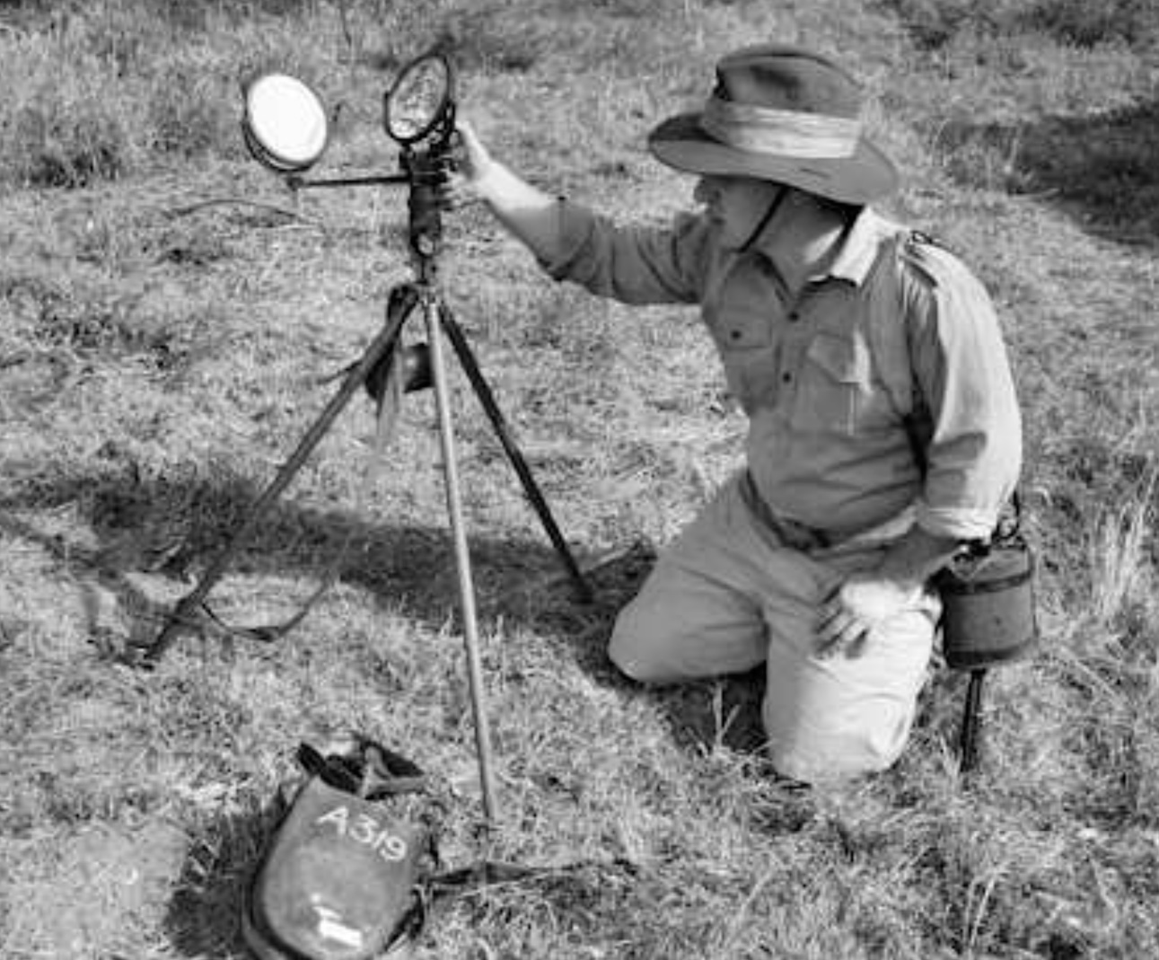

‘Heliograph signalling – Privates, Underhill, Jones and Pope’, Sollum, Egypt, 1917 (c).
Photograph, World War One, Middle East (1914-1918), 1917 (c).
A soldier of 10th Battalion, The Buffs, uses a heliograph to signal while his comrade watches through a telescope for a reply. A heliograph used a mirror to reflect sunlight to a distant observer. By moving the mirror, flashes of light could be used to send Morse code. The 10th Battalion was formed at Sollum in Egypt on 1 February 1917 from two dismounted Yeomanry Regiments.
From an album of 36 negatives compiled by Pte W L Pope, No. 5 Pln, 10th Bn The Buffs (East Kent Regiment).
NAM Accession Number
NAM. 2000-10-255-17
Copyright/Ownership
National Army Museum Copyright
Location
National Army Museum, Study collection
Object URL
https://collection.nam.ac.uk/detail.php?acc=2000-10-255-17


Please copy the following into your search box and enter: http://m.parkweb.vic.gov.au/explore/parks/dandenong-ranges-national-park/things-to-do/one-tree-hill-picnic-ground?original_referrer=http%3A%2F%2Fparkweb.vic.gov.au%2Fexplore%2Fparks%2Fdandenong-ranges-national-park%2Fthings-to-do%2Fone-tree-hill-picnic-ground&asset_id=#overview
Please copy the following into your search box and enter: http://www.dandenongrangespoint.com.au/attractions/1000-steps/
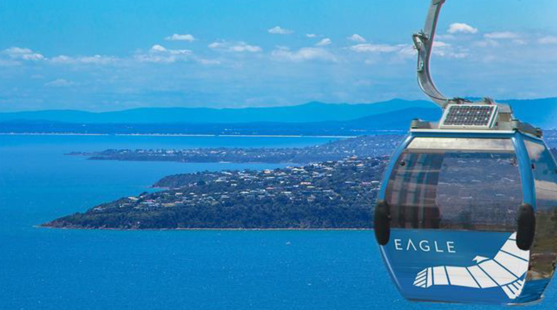
6. Western Port 40M.
Sister Port to Port Phillip Bay with a deep harbour at Hastings and the nearby HMAS Cerberus Navy Training Base.


Please copy the following into your search box and enter: https://en.m.wikipedia.org/wiki/Western_Port
Please copy the following into your search box and enter: http://www.portofhastings.com/
Please copy the following into your search box and enter: http://www.navy.gov.au/establishments/hmas-cerberus
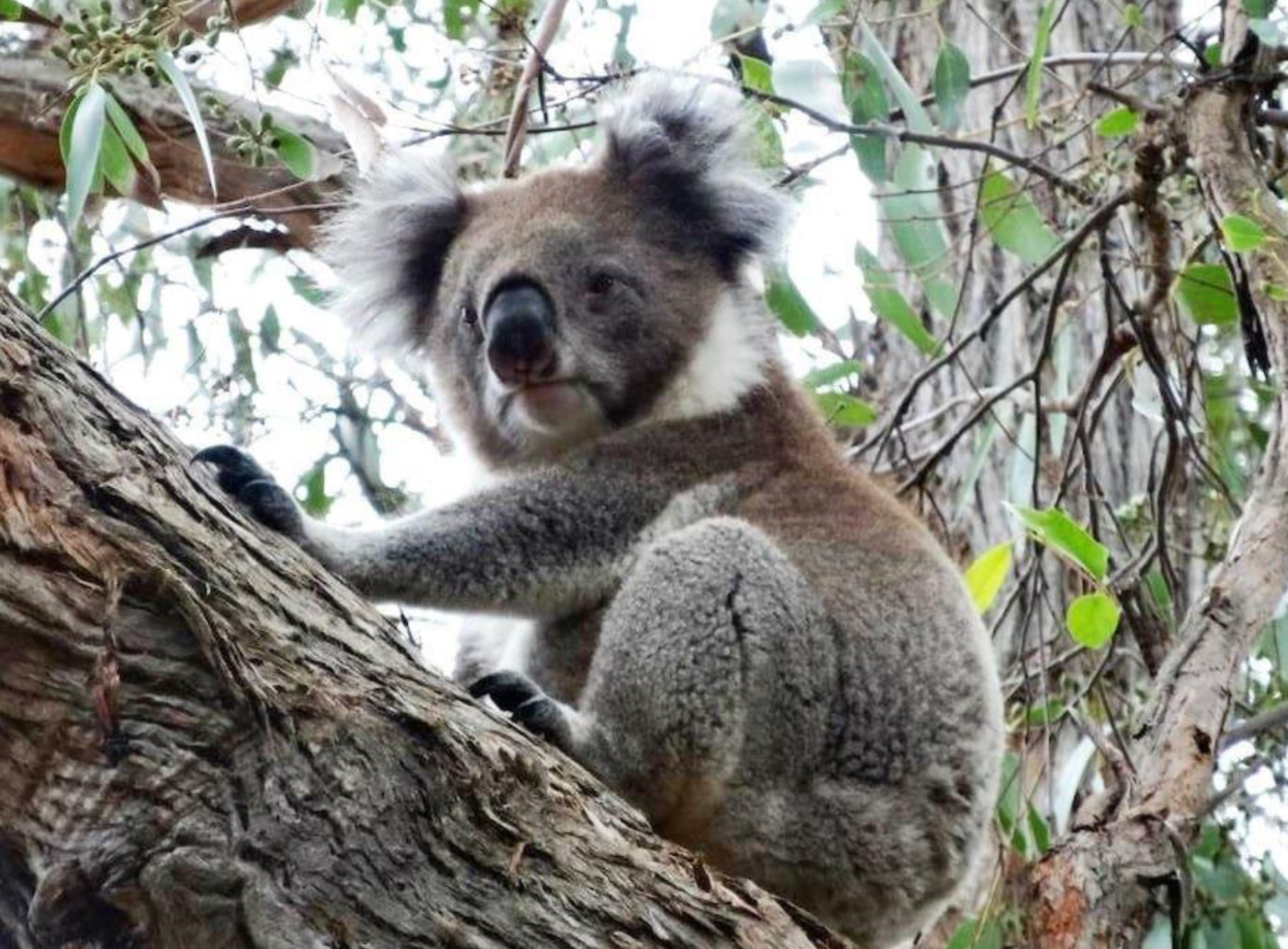
7. French Island 48M.
A low lying island adjoining Phillip Island in Westernport Bay. Access is by Ferry from Stony Point. It is like going back 50 years because it has not been highly developed like its neighbour. There is a large colony of Koalas on the Island, feeding on the Coastal Form of Manna Gum, which they threaten to denude because of overpopulation every now and then.


Please copy the following into your search box and enter: http://m.parkweb.vic.gov.au/explore/parks/french-island-national-park?original_referrer=http%3A%2F%2Fparkweb.vic.gov.au%2Fexplore%2Fparks%2Ffrench-island-national-park&asset_id=#overview
The View to the South.
8. Arthur’s Seat 30M.
Named after Arthur’s Seat in Edinburgh, Scotland.
Please copy the following into your search box and enter: http://www.visitvictoria.com/regions/Mornington-Peninsula/Destinations/Arthurs-Seat
Please copy the following into your search box and enter: https://en.wikipedia.org/wiki/Arthurs_Seat,_Victoria
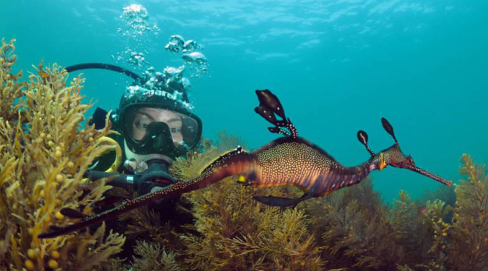
9. Port Phillip Heads 54M.
Extraordinary stretch of water with The Rip at it’s centre draining Port Phillip Bay into Bass Strait. It is the most tropical of the Bay’s waterways with beautiful seaweeds and corals, magnificent fish and deadly blue-ringed octopii. It is treacherous above and below water as it is the site of numerous ship wrecks.

Please copy the following into your search box and enter: http://parkweb.vic.gov.au/explore/parks/port-phillip-heads-marine-national-park
Please copy the following into your search box and enter: https://en.wikipedia.org/wiki/The_Rip
Please copy the following into your search box and enter: https://en.wikipedia.org/wiki/Port_Phillip
10. Portarlington 43M. Across the other side of Port Phillip Bay is the Bellarine Peninsular.
Please copy the following into your search box and enter: https://en.wikipedia.org/wiki/Portarlington,_Victoria
Please copy the following into your search box and enter: https://www.travelvictoria.com.au/portarlington/
11. Melbourne 17M.
Capital City of Victoria. Most Liveable City in the World every year. Sporting Capital of Australia. Great coffee and lifestyle.
Please copy the following into your search box and enter:
http://www.visitvictoria.com/
Please copy the following into your search box and enter:
https://en.wikipedia.org/wiki/Melbourne
12. Flinders Peak 47M.
The highest peak in the You Yangs. This range is composed of granite. Flinders Peak is an excellent place to lookout over Geelong and Corio Bay.
Please copy the following into your search box and enter: http://parkweb.vic.gov.au/explore/parks/you-yangs-r.p./things-to-do/flinders-peak
Please copy the following into your search box and enter: https://en.wikipedia.org/wiki/You_Yangs
Please copy the following into your search box and enter: https://www.trailhiking.com.au/flinders-peak/
13. Mt. Atkinson 31M.
This scoria cone is on the way to be a new Western Melbourne suburb.
Please copy the following into your search box and enter: http://www.mountatkinson.com/

The View to the West.
14. Mt Blackwood 49M.
Blackwood is a township in Victoria, Australia. The township is located on the Lerderderg River, 89 kilometres north west of the state capital, Melbourne. Situated in The Wombat State Forest. Blackwood is in the Shire of Moorabool local government area and had a population of 297 at the 2011 census. The town currently consists of a pub, an artisan cafe & store, a post office and a cafe and plant nursery at The Garden of St Erth.
The township was founded in 1855 during the Victorian gold rush and at one stage had a population of around 13,000 prospectors. The Post Office opened on 22 September 1855 and was known as Mount Blackwood until 1921.
Attractions include outdoor activities and camping in the Lerderderg State Park and Wombat State Forest. The Blackwood Merchant artisan cafe & store, The Garden of St Erth, Blackwood Pub, Blackwood Mineral Springs Holiday Park, miners’ cottages from the 1860s and Mount Blackwood. Mount Blackwood is an extinct volcano, offering panoramic views of the surrounding area.
Please copy the following into your search box and enter: https://en.wikipedia.org/wiki/Blackwood,_Victoria
15. Camels Hump and Mt Macedon 41M.

Like nearby Hanging Rock, this rocky outcrop is a mamelon – a volcanic feature formed six million years ago when thick lava squeezed through a narrow vent in the earth’s crust. The highest peak in the range, Camels Hump offers superb views of Hanging Rock and the surrounding countryside.
Please copy the following into your search box and enter: http://m.visitvictoria.com/Regions/Daylesford-and-the-Macedon-Ranges/Destinations/Mount-Macedon?MobileRedirected=1
16. Big Hill of Pretty Sally 26M.
Pretty Sally or Pretty Sally Hill is a dormant volcanic cone located between Wallan and Kilmore in Victoria, Australia. It is 529 metres above sea level. It arises from the surrounding open undulating plains of a broad gap in the Great Dividing Range. The original road to Sydney ran near the peak known as the Big Hill. Sally Smith (better known as “Pretty Sally”) operated an unlicensed hotel there in the 1840s. She died falling under her cart after striking a stump.
Please copy the following into your search box and enter: https://en.wikipedia.org/wiki/Pretty_Sally
Please copy the following into your search box and enter: https://kilmorehistory.wordpress.com/2015/09/03/what-happened-to-pretty-sally/
17. Whittlesea 18M.
Ubiquitous, the City of Whittlesea now flows northwards up Plenty Road, a sea of houses with few distributer roads and services, engulfing older small townships, and the Township of Whittlesea will be absorbed by 2030.
Please copy the following into your search box and enter: https://en.wikipedia.org/wiki/Whittlesea,_Victoria
Please copy the following into your search box and enter: http://www.whittleseatourism.com.au/
Please copy the following into your search box and enter: https://www.whittlesea.vic.gov.au/
18. Mt. Disappointment 10M.
After making the arduous climb to the summit, British explorers Hume and Hovell hoped to view the distant Port Phillip Bay. Unfortunately, the mountain’s many trees prevented this resulting in their immense disappointment. Consequently they recorded their feelings in the name they chose for the mountain.

Please copy the following into your search box and enter: https://en.wikipedia.org/wiki/Mount_Disappointment_(Australia)
19. Sugarloaf 11M.
Nestled in the Christmas Hills, Sugarloaf is a tranquil setting for a picnic or a stroll near the reservoir shores, offering wonderful views across the water. For the more energetic, there is a 15km walk that circumnavigates the reservoir.

Please copy the following into your search box and enter: http://www.visitvictoria.com/regions/Yarra-Valley-and-Dandenong-Ranges/Things-to-do/Nature-and-wildlife/National-parks-and-reserves/Sugarloaf-Reservoir-Park.aspx

The View to the North.
20. Kinglake 18M
(and Kinglake West) are small towns on the ridgeline. The Soil is magnificent and the rainfall high so a highly productive.


Please copy the following into your search box and enter: https://en.m.wikipedia.org/wiki/Kinglake,_Victoria
Please copy the following into your search box and enter: http://m.parkweb.vic.gov.au/explore/parks/kinglake-national-park?original_referrer=http%3A%2F%2Fparkweb.vic.gov.au%2Fexplore%2Fparks%2Fkinglake-national-park&asset_id=
21. Cookson’s Hill 11M.

Please copy the following into your search box and enter: https://www.google.com.au/maps/place/Cooksons+Hill/@-37.55,145.3311446,17z/data=!3m1!4b1!4m5!3m4!1s0x6ad7d1c90f31723b:0xedf90466c28d339c!8m2!3d-37.55!4d145.3333333!5m1!1e4
Please copy the following into your search box and enter: http://bushwalkjournal.blogspot.com.au/2011/04/cookson-hill-track-kinglake-national.html
22. The Cathedral 38M.
The Cathedral Range is past Marysville and quite spectacular, enjoyed by Bushwalkers and Campers.


Please copy the following into your search box and enter:
https://g.co/kgs/aCSqAc
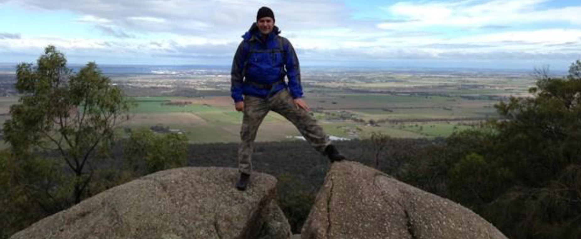
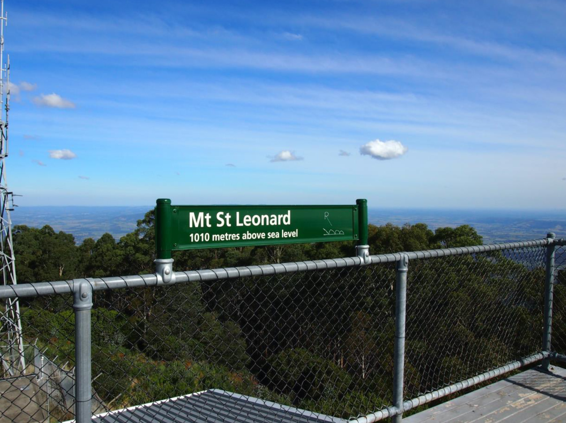
23. Mt St Leonard 11M.
Mt St Leonard dominates the northern skyline of Healesville. It has a Lookout Tower

Please copy the following into your search box and enter:
https://g.co/kgs/IzWu7g
24. Mt Mondo 25M.
Dom Dom Saddle – Mt Monda – Narbethong, Yarra Ranges National Park
From Melbourne, follow the Maroondah Highway through Ringwood, Lilydale and Coldstream to Healesville (64kms).
From Healesville continue on the Maroondah Highway for 16.5kms passing the Maroondah Dam on the left and Fernshaw Reserve on the right, from where the highway climbs the ‘Black Spur’. At the crest turn right (take care of oncoming traffic) into the Dom Dom saddle picnic area car park.A car shuffle will be required with a car/s to be left at the end point at Natbethong a further 5km along on the Maroondah Highway.
Maps
Vicmap: Online access to 1:30,000 topographic maps A4 Map sheets 8022 4-4-1, 8022 4-1-4, 8022 4-1-3, 8022 4-4-2
Please copy the following into your search box and enter: http://www.bushwalkingvictoria.org.au/walks-directory/item/dom-dom-saddle-mt-monda-narbethong
25. Mt Dom Dom 25M.
Mt Dom Dom adjoins Dom Dom Saddle the connection of the Maroondah Highway beyond Healesville to all points north. The Tree Ferns and Towering Mountain Ash are part of this wonderful drive known as The Black Spur.


Please copy the following into your search box and enter: https://en.wikipedia.org/wiki/Mount_Dom_Dom
26. Mt Juliet 22M.


Mt Juliet is amongst the highest peaks in the Yarra Ranges region, with the summit at 1120m. The highest is nearby Mt Donna Buang, 1223m.
The mountain lies within the Melbourne Water Maroondah Catchment Area, and a very steep walking track leads to the Summit. Public vehicular and walker access on the network of management roads in the vast catchment area surrounding the mountain is prohibited, excepting some roads which walkers are permitted to use. The first part of the track follows Road Three, a management road, for about 2 km from the gate at the Maroondah Highway, 7 km east of Healesville. The foot track starts at the junction of this road and Road Five – from there it is 4.5 km to the summit, where a stone cairn is located. Mountain ash regrowth at the summit currently restricts the view of the surrounding hills.
According to historian George Start, the cleared area around the cairn was visible from the fire tower on Mt St Leonard during the 1950s, but the regrowth of mountain ash following the 1939 fires has now reached a height that obscures the summit and views from the summit. Mt Juliet is one of several trigonometric cairns remaining from the original Geodetic Survey of Victoria. The summit walk is amongst the most difficult in the Ranges, with a rise in altitude from 211m to 1120m, with the final section over rocks. Mt Juliet developed as a popular destination for walkers visiting the Healesville area at the turn of the century.
Writing in J.W. Lindt`s visitor`s guide to the area in c.1910, Nicholas Caire described the scene that rewarded walkers after the arduous climb to the summit:
“A trigonometrical station. The highest and about the most accessible mountain near Healesville, from the top of which a most extended panorama is obtained of the surrounding country. Melbourne, the Bay, Macedon, and the You Yangs, being easily seen on a clear day. Snow lies on the summit during winter”.
On May 18, 2008, I did the lower 4 km (return) section of the Track along Road Three, which was a rise in altitude of 105m. Perhaps one day I may attempt the full walk, but the thought of a 900m climb with no views at the top is not to my liking!
Posted by Bob Padula on –
Please copy the following into your search box and enter: http://bushwalkjournal.blogspot.com.au/2008/05/mt-juliet-walkiing-track-yarra-ranges.html
Please copy the following into your search box and enter: https://www.trailhiking.com.au/mount-juliet-8-7km/